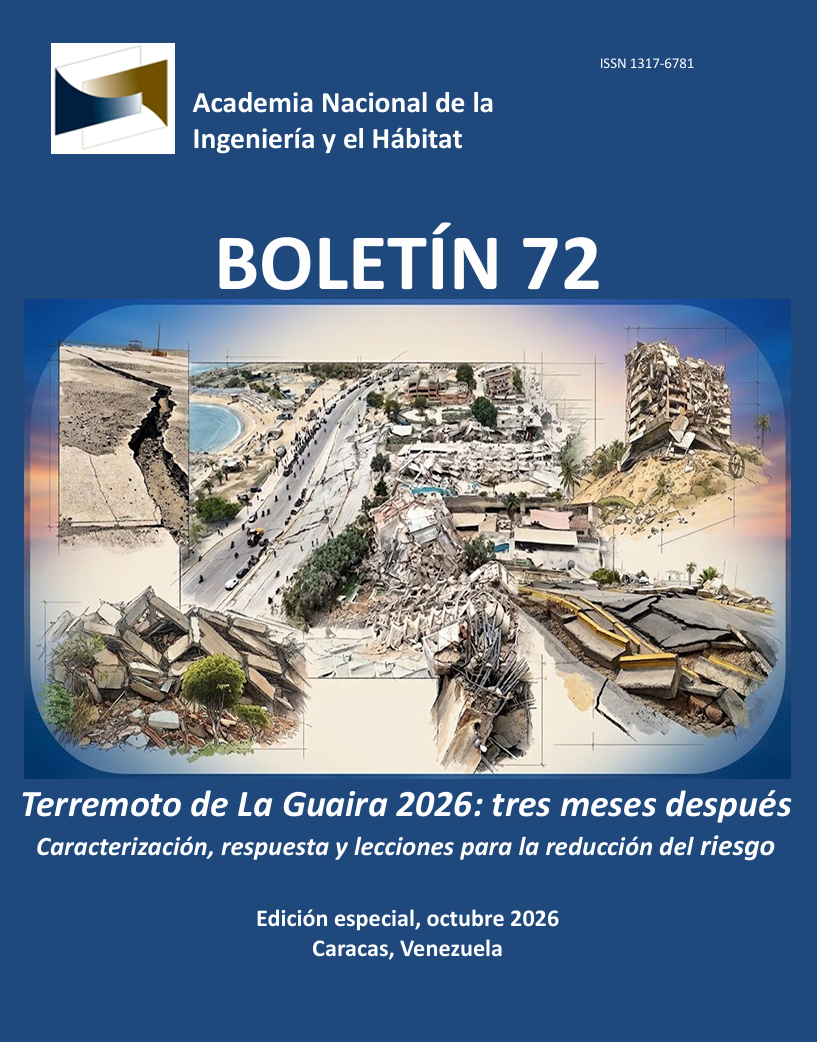
Los terremotos del 24 de junio de 2026 en Venezuela. Revisión de la fuente sísmica, efectos de campo cercano, respuesta de sitio y lecciones para la normativa sismorresistente.
Palabras clave:
Venezuela, Terremotos de 2026, La Guaira, San Sebastián, Campo cercano, Directividad de ruptura, Pulsos de velocidad, Doblete sísmico, Microzonificación, COVENIN 1756-1:2019, Diseño sismorresistenteResumen
Los terremotos del 24 de junio de 2026 plantean una cuestión central para la ingeniería sísmica venezolana: cómo interpretar una secuencia en la que magnitud, proximidad a la fuente, poca profundidad, extensión de ruptura, directividad, condiciones locales del suelo y la ocurrencia de dos eventos mayores separados por pocos segundos actuaron de manera combinada. En estructuras próximas a fallas extensas, la distancia mínima a la superficie de ruptura, la dirección de propagación, la distribución del deslizamiento y las características de los pulsos pueden ser tan importantes como la magnitud o la distancia epicentral.
La evolución de las soluciones del U.S. Geological Survey (USGS) ilustra esta complejidad. Mientras el evento Mw 7,2 permaneció asociado al sector oriental de San Felipe, la solución revisada del Mw 7,5 fue desplazada significativamente hacia el este, hasta localizarse aproximadamente 17 km al oeste de Catia La Mar. La incorporación de información adicional, incluyendo observaciones InSAR de NISAR, permitió refinar el modelo de falla finita, particularmente en el tramo oriental de la ruptura.
Este trabajo examina los efectos de campo cercano, la directividad de ruptura, los pulsos de velocidad, el desplazamiento tectónico permanente, la direccionalidad de las componentes horizontales y la posible carga secuencial asociada a dobletes. También revisa la Norma Venezolana COVENIN 1756-1:2019 y su tratamiento de la proximidad a fallas, la microzonificación y los estudios especiales de amenaza.
A partir de las experiencias de Valdivia, Northridge, Kobe, Chi-Chi y Türkiye, se propone una agenda de revisión para Venezuela que incluya criterios explícitos para estudios de campo cercano, uso de distancia a la ruptura, actualización de mapas de fallas activas, análisis probabilístico y por escenarios, reglas para selección de registros con pulsos, fortalecimiento de la microzonificación, evaluación de la componente vertical e instrumentación sísmica. La ausencia de registros locales de movimiento fuerte en 2026 limita la capacidad de aprendizaje y refuerza la necesidad de reconstruir una red sismológica nacional.
Citas
Ambrosio, R, (2002). Modelaje gravimétrico del basamento de los conos aluviales de La Guaira, Macuto y Caraballeda. Estado Vargas. Geos, UCV, Caracas, 35: 57-58 + 105 p. en CD (carpeta 4.8). Trabajo Especial de Grado, tutores: R. Meza, I. Rodríguez y N. Orihuela.
Audemard, F. A., Machette, M. N., Cox, J. W., Dart, R. L., & Haller, K. M. (2000). Map and database of Quaternary faults in Venezuela and its offshore regions. U.S. Geological Survey Open-File Report 2000-18, 78 p. https://doi.org/10.3133/ofr0018
Audemard M., F. A., Singer P., A., & Soulas, J.-P. (2006). Quaternary faults and stress regime of Venezuela. Revista de la Asociación Geológica Argentina, 61(4), 480-491.
Baker, J. W. (2007). Quantitative classification of near-fault ground motions using wavelet analysis. Bulletin of the Seismological Society of America, 97(5), 1486-1501. https://doi.org/10.1785/0120060255
Beltrán, C.(1993). Mapa neotectónico de Venezuela. Caracas: Edic. FUNVISIS, Escala 1:2.000.000
Bernal, G., & Cardona, O.-D. (2026). Una excepcional demanda sísmica y sus implicaciones para el diseño sismorresistente: Modelación del movimiento fuerte derivado del segundo sismo del 24 de junio de 2026 en Venezuela. INGENIAR Risk Intelligence. https://doi.org/10.13140/RG.2.2.30181.56804
Bradley, B. A., & Weatherill, G. (2025). Consideration of near-fault effects in New Zealand seismic hazard analysis and design spectra. Bulletin of the New Zealand Society for Earthquake Engineering, 58(2), 108-117. https://doi.org/10.5459/bnzsee.1743
Bray, J. D., & Rodriguez-Marek, A. (2004). Characterization of forward-directivity ground motions in the near-fault region. Soil Dynamics and Earthquake Engineering, 24(11), 815-828. https://doi.org/10.1016/j.soildyn.2004.05.001
Building Seismic Safety Council. (2020). 2020 NEHRP Recommended Seismic Provisions for New Buildings and Other Structures. FEMA P-2082-1, Volume I. Federal Emergency Management Agency, Washington, D.C.
California Geological Survey. (1998). Maps of Known Active Fault Near-Source Zones in California and Adjacent Portions of Nevada. Seismic Hazard Mapping Bulletin No. 7. California Department of Conservation.
Colón, S., Audemard, F. A., Beck, C., Avila, J., Padrón, C., De Batist, M., Paolini, M., Leal, A. F., & Van Welden, A. (2015). The 1900 Mw 7.6 earthquake offshore north-central Venezuela: Is La Tortuga or San Sebastián the source fault? Marine and Petroleum Geology, 67, 498-511. https://doi.org/10.1016/j.marpetgeo.2015.06.005
Comisión Venezolana de Normas Industriales (COVENIN). (2001). COVENIN 1756-1:2001. Edificaciones sismorresistentes. Parte 1: Articulado. FONDONORMA, Caracas.
Comisión Venezolana de Normas Industriales (COVENIN). (2019). COVENIN 1756-1:2019. Construcciones sismorresistentes. Parte 1: Requisitos (2da revisión). Norma venezolana de referencia para diseño sismorresistente. Caracas. Aprobada por el organismo normativo competente en 2020.
Čejka, F., Zahradník, J., Turhan, F., Sokos, E., et al. (2023). Long-period directivity pulses of strong ground motion during the 2023 Mw7.8 Kahramanmaraş earthquake. Communications Earth & Environment, 4, 413. https://doi.org/10.1038/s43247-023-01076-x
Earthquake Engineering Research Institute (EERI). (2026). EERI Learning from Earthquakes VERT Report: Phase 1 Response to the M7.2 & M7.5 Yumare, Venezuela Earthquakes, June 24, 2026. 30 June 2026. https://learningfromearthquakes.org/resources/vert-report-phase-1-response-to-the-m7-2-m7-5-yumare-venezuela-earthquakes-june-24-2026/
Genatios, C. (2026). Vargas, La Guaira: de los deslaves a los terremotos. Boletín Especial de la Academia Nacional de la Ingeniería y el Hábitat, septiembre de 2026.
GFZ Helmholtz Centre for Geosciences. (2026). Severe Earthquake in Venezuela | GFZ Information | Status Report. 26 June 2026, Potsdam, Germany
GFZ German Research Centre for Geosciences. (2026). GEOFON Earthquake Explorer: Seismic event map for northern Venezuela (M7.3 and M7.4 events, June 25, 2026). Potsdam, Germany. Retrieved from gfz-potsdam.de
International Conference of Building Officials. (1997). Uniform Building Code, Volume 2, Structural Engineering Design Provisions. Whittier, California.
Kamai, R., Abrahamson, N. A., & Graves, R. W. (2014). Adding fling effects to processed ground-motion time histories. Bulletin of the Seismological Society of America, 104(4). https://doi.org/10.1785/0120130272
Lafuente, M. (2026) El sismo del 24 de junio de 2026 en Venezuela: análisis preliminar de daños en Caracas y La Guaira, y lecciones para la gestión del riesgo.Boletín Especial de la Academia Nacional de la Ingeniería y el Hábitat, septiembre de 2026
Mavroeidis, G. P., & Papageorgiou, A. S. (2003). A mathematical representation of near-fault ground motions. Bulletin of the Seismological Society of America, 93(3), 1099-1131. https://doi.org/10.1785/0120020100
Mavroeidis, G. P., Dong, G., & Papageorgiou, A. S. (2004). Near-fault ground motions, and the response of elastic and inelastic single-degree-of-freedom systems. Earthquake Engineering & Structural Dynamics, 33(9), 1023-1049. https://doi.org/10.1002/eqe.391
Méndez Galindo, C., Tapia Hernández, E., Botero Jaramillo, E., Guerrero Bobadilla, H., Pérez Liévana, K., Osorio Flores, L., Pinto Carvalho, L., Baena Rivera, M. E., & Serrano Vega, S. (2026). Reporte de Daños: Sismos de Venezuela del 24 de junio de 2026. Sociedad Mexicana de Ingeniería Sísmica, Comité Aprendiendo de los Sismos. https://doi.org/10.13140/RG.2.2.21678.27201
NASA Earth Observatory. (2026). Where Venezuela’s Earthquakes Shifted the Ground. 10 July 2026. https://science.nasa.gov/earth/earth-observatory/where-venezuelas-earthquakes-shifted-the-ground/
New Zealand Standards. (2004). NZS 1170.5:2004 Structural Design Actions, Part 5: Earthquake Actions - New Zealand. Standards New Zealand, Wellington.
Pitarka, A., Irikura, K., Iwata, T., & Sekiguchi, H. (1998). Three-dimensional simulation of the near-fault ground motion for the 1995 Hyogo-ken Nanbu (Kobe), Japan, earthquake. Bulletin of the Seismological Society of America, 88(2), 428-440. https://doi.org/10.1785/BSSA0880020428
Plafker, G., & Savage, J. C. (1970). Mechanism of the Chilean earthquakes of May 21 and 22, 1960. Geological Society of America Bulletin, 81(4), 1001-1030. https://doi.org/10.1130/0016-7606(1970)81[1001:MOTCEO]2.0.CO;2.
Poulos, A., & Miranda, E. (2022). Probabilistic characterization of the directionality of horizontal earthquake response spectra. Earthquake Engineering & Structural Dynamics, 51(9), 2077-2090. https://doi.org/10.1002/eqe.3654.
Poulos, A., & Miranda, E. (2023). Modification of ground-motion models to estimate orientation-dependent horizontal response spectra in strike-slip earthquakes. Bulletin of the Seismological Society of America, 113(6), 2718-2729. https://doi.org/10.1785/0120230084
Red Sísmica de Puerto Rico. (2026). Información General del Evento, 24 de junio de 2026, M 7.5 Mww, cerca de la costa de Venezuela, latitud 10.622, longitud -67.194, profundidad 10 km. Universidad de Puerto Rico en Mayagüez. https://redsismica.uprm.edu/spanish/informe_sismo/myInfoGeneral.php?id=20260624220435
Romero, M., Cragno, A., Schmitz, M., & Ambrosio, R. (2006). Caracterización de suelos con métodos geofísicos en La Guaira, Macuto, Caraballeda y Tanaguarena, estado Vargas, Venezuela. Boletín Técnico, 44(1), 16-29. http://ve.scielo.org/scielo.php?script=sci_arttext&pid=S0376-723X2006000100002
Schmitz, M. (2026). Aportes de la Microzonificación Sísmica para la Mitigación del Riesgo Sísmico en Venezuela. Avances y Desafíos: Trabajo de Incorporación Académica (TIA) ante la Academia Nacional de la Ingeniería y el Hábitat (ANIH),Boletín de la ANIH, N.º 71.
Seed, H. B., Whitman, R. V., Dezfulian, H., Dobry, R., & Idriss, I. M. (1972). Soil conditions and building damage in 1967 Caracas earthquake. Journal of the Soil Mechanics and Foundations Division, 98(8), 787-806. https://doi.org/10.1061/JSFEAQ.0001768
Shahi, S. K., & Baker, J. W. (2014). NGA-West2 models for ground-motion directionality. Earthquake Spectra, 30(3), 1285-1300. https://doi.org/10.1193/040913EQS097M
Somerville, P. G., Smith, N. F., Graves, R. W., & Abrahamson, N. A. (1997). Modification of empirical strong ground motion attenuation relations to include the amplitude and duration effects of rupture directivity. Seismological Research Letters, 68(1), 199-222. https://doi.org/10.1785/gssrl.68.1.199
Spudich, P. A., Rowshandel, B., Shahi, S. K., Baker, J. W., & Chiou, B. S.-J. (2014). Comparison of NGA-West2 directivity models. Earthquake Spectra, 30(3), 1199-1221. https://doi.org/10.1193/080313EQS222M
Taiwan Architecture and Building Research Institute, Ministry of the Interior. (2000-2002). Research reports on modification of Taiwan building seismic design provisions considering near-fault effects and uniform hazard response. Taipei.
U.S. Geological Survey (USGS). (1996). USGS Response to an Urban Earthquake: Northridge ’94. U.S. Geological Survey Open-File Report 96-263.
U.S. Geological Survey (USGS). (2026a). M 7.2 - 20 km E of San Felipe, Venezuela, event us6000t7zc. Earthquake Hazards Program. https://earthquake.usgs.gov/earthquakes/eventpage/us6000t7zc/executive
U.S. Geological Survey (USGS). (2026b). M 7.5 - 17 km W of Catia La Mar, Venezuela, event us6000t7zp. Earthquake Hazards Program. https://earthquake.usgs.gov/earthquakes/eventpage/us6000t7zp/executive
Urbani Patat, F. (2026). Los terremotos del 24 de junio de 2026 en Venezuela: Recopilación de mapas e información geocientífica. V.2. Boletín de la Academia Nacional de la Ingeniería y el Hábitat, (71), S4. https://n2t.net/ark:/42414/banih/712026/142
Yen, M.-H., Türker, E., Ulrich, T., Marchandon, M., Gabriel, A.-A., & Cotton, F. (2025). An analysis of directivity pulses using empirical data and dynamic rupture simulations of the 2023 Kahramanmaraş earthquake doublet. Earthquake Spectra, 41(2). https://doi.org/10.1177/87552930241305012
Descargas
Publicado
Cómo citar
Número
Sección
ARK
Licencia

Esta obra está bajo una licencia internacional Creative Commons Atribución-NoComercial-CompartirIgual 4.0.